
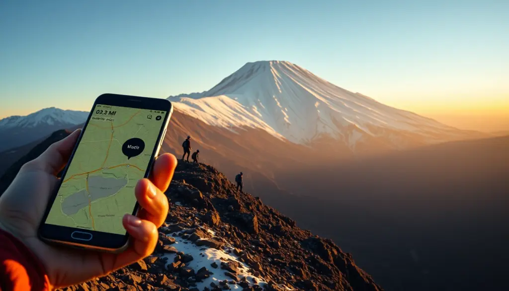
Three novice hikers who leaned on Google’s Gemini AI to plan a summit attempt on Mount Shasta ended up spending an unplanned night on the mountain after their trip ran twice as long as the chatbot told them it would. Rangers in Siskiyou County, California, reached the group after a climb that Gemini had framed as an eight-hour outing stretched to roughly sixteen hours, according to reporting from the San Francisco Chronicle and Engadget. The men, college students from Roseville, California, had packed food and water for the shorter timeline, not for a mountain that punished their optimism.
The story has become one of the most-discussed AI news items of the week because it lands at the intersection of two trends readers already worry about: chatbots replacing expert judgment, and outdoor recreation drawing more first-timers who reach for an app instead of a guidebook. Mount Shasta rises to 14,179 feet in Northern California, and it does not forgive a bad plan. This piece walks through what happened, what Gemini reportedly told the climbers, how the rescue unfolded, and what the incident says about AI tools that were never built to be safety-critical.
What Happened on Mount Shasta: A Timeline
According to multiple outlets covering the rescue, three young men set out from the Clear Creek Trailhead on Mount Shasta’s southeastern side to attempt a summit climb. They used Google’s Gemini AI chatbot to plan the route and decide what gear, food, and water to bring, supplementing it with AllTrails data and YouTube videos, a combination increasingly common among hikers who skip a guide service or a local ranger station briefing.
Gemini reportedly told them to expect an eight-hour climb. The actual attempt took close to sixteen hours, roughly double the estimate. That gap mattered because the group had packed supplies sized for the shorter trip. By the time they were deep into the climb, they were short on food and water and navigating unfamiliar terrain in Mud Creek Canyon, an area off the standard route. They ended up spending at least one night at approximately 11,000 feet without adequate shelter.
Their cell phone, the tool they were using for directions once they lost the trail, died during the descent. That left them without GPS, without a way to call for help directly, and without the AllTrails maps they had relied on earlier in the trip. Rangers eventually located and reached the group, and at least one hiker sustained a knee injury during the ordeal. Exact rescue timing has been reported inconsistently across outlets, with some placing the ranger contact around 9:30 a.m. on the Sunday following the climb and others citing a slightly different date, so this piece treats the precise hour of contact as unconfirmed while treating the broader sequence of events as established by multiple reports.
| Detail | What Gemini Suggested / Planned | What Actually Happened |
|---|---|---|
| Climb duration | About 8 hours | About 16 hours |
| Food and water | Packed for a short day trip | Ran short mid-climb |
| Nutrition advice | Simple carbohydrates over fats | Left them without sustained energy for a longer ordeal |
| Navigation | AllTrails, YouTube, phone GPS | Went off-route into Mud Creek Canyon; phone battery died |
| Shelter | Not planned for an overnight stay | Spent at least one night near 11,000 feet exposed |
Who Are the Three Hikers
News coverage describes the group as novice hikers, young men and college students from Roseville, a Sacramento-area suburb roughly 250 miles south of Mount Shasta. None of the outlets covering the rescue have named the men publicly at the time of this report, and no legal or medical status beyond a reported knee injury to one climber has been confirmed. That detail alone is part of why the story spread: this was not a case of seasoned mountaineers misjudging a known-hard route, it was a group treating a 14,000-foot peak the way they might treat a day hike, in part because an AI assistant gave them a timeline that undersold the mountain.
Mount Shasta is not a technical climb by mountaineering standards, but it is a serious undertaking. It sits in Siskiyou County in far Northern California, has significant elevation gain from any trailhead, and its weather and terrain can turn a manageable day into an emergency fast, especially for hikers without prior high-altitude experience. Search-and-rescue teams in the region handle Shasta incidents regularly, and the mountain’s popularity with first-time summit-seekers, driven partly by social media and trip-planning apps, has been a recurring theme in local rescue reports.
How Gemini AI Shaped Their Route and Gear List
The core of this story is not that three young men got in over their heads on a mountain. That happens. It is that they outsourced the judgment calls, route timing, gear list, food and water quantities, to a general-purpose AI chatbot that was never built or certified as a wilderness safety tool. Google’s Gemini is a conversational assistant designed to answer a huge range of questions, from coding help to travel itineraries. It was not trained against a verified database of Mount Shasta trail conditions, current snowpack, or the physical toll a 14,000-foot ascent takes on hikers with no altitude experience.
That is the structural problem reporters and safety officials have zeroed in on. An AI chatbot will answer a question about “how long does it take to climb Mount Shasta” with a plausible-sounding number, but plausible is not the same as accurate for a specific party’s fitness level, chosen route, and the day’s conditions. The eight-hour estimate the hikers reportedly received undershot their actual time on the mountain by roughly a factor of two, and that gap turned a manageable supply plan into a shortage.
The Nutrition Advice That Backfired
One detail that has drawn particular attention is the food guidance Gemini reportedly gave the group. According to reports, the chatbot recommended simple carbohydrates over fats for their climb, reasoning that fats “take too long to digest.” That is defensible advice for a short, intense effort where fast-burning energy matters more than sustained fuel. It is a much weaker choice for an unplanned overnight ordeal at altitude, where slower-burning fat reserves and a food plan with margin for delay matter more than a quick sugar boost.
In other words, the advice may have been reasonable for the trip Gemini thought they were taking, an eight-hour day hike, and poorly suited to the trip they actually ended up on. That mismatch is the throughline of the whole incident: individually plausible pieces of advice compounding into a plan that could not absorb the mountain’s real demands.
The Rescue: Rangers, Mud Creek Canyon, and a Dead Phone
Once the hikers lost the marked trail, they ended up in Mud Creek Canyon, terrain that is not part of the standard summit route from the Clear Creek Trailhead. Reports indicate they spent at least one night at roughly 11,000 feet without proper shelter, food, or water for that duration. Their phone, which had become their primary navigation tool after departing from the plan Gemini and AllTrails had mapped out, lost its charge during the descent, cutting off both GPS guidance and any direct line to call for help.
Rangers ultimately located and reached the group. Coverage varies on the exact hour, some reports cite roughly 9:30 a.m. on the Sunday after the climb began, while at least one other account places the ranger contact around the same time the following day, so this article treats the specific timestamp as unresolved. What is consistent across every report is that the rescue happened, that it followed a climb roughly double the AI-estimated duration, and that at least one hiker came away with a knee injury. Siskiyou County officials described the reliance on AI trip planning as a serious misstep, and used the incident to renew a message search-and-rescue teams repeat every season: do not treat any single tool, AI included, as a substitute for verified local trail data and a realistic buffer for the unexpected.
Why AI Trip Planners Miscalculate Wilderness Time
Large language models like Gemini generate answers by pattern-matching against training data and web content, not by running a physics simulation of a specific party’s pace on a specific slope under that day’s conditions. Ask a general-purpose chatbot how long a climb takes, and it will produce a number that sounds authoritative because it is phrased with confidence, drawing on trip reports, guide-service pages, and forum posts that may describe experienced climbers moving at a faster pace than novices, or a different route entirely, or a different season’s conditions.
None of the major consumer AI assistants, Gemini included, currently ask enough clarifying questions to size an estimate to an individual party’s fitness, altitude acclimatization, or gear before handing back a duration. A hiking guide or a ranger station briefing would ask about prior high-altitude experience, current conditioning, and planned pace before giving a number, and would attach margin for weather, route-finding delays, and rest breaks. A chatbot, by contrast, tends to answer the literal question asked and present the answer with the same even, confident tone whether the underlying data is solid or thin.
Google Gemini vs Rival AI Assistants on Outdoor Safety Guidance
Google Gemini, OpenAI’s ChatGPT, Anthropic’s Claude, and xAI’s Grok are all built as general-purpose assistants, and none of them are marketed or certified as wilderness safety or route-planning tools. Each company publishes some form of general disclaimer noting that the assistant can make mistakes and that users should verify important information, but none of the four currently ship a dedicated, liability-aware mode for backcountry trip planning that pulls from verified ranger-station data, current trail closures, or real-time weather and snowpack conditions.
| AI Assistant | Maker | General Safety Disclaimer | Dedicated Wilderness/Route-Planning Mode |
|---|---|---|---|
| Gemini | Yes, general-purpose | No | |
| ChatGPT | OpenAI | Yes, general-purpose | No |
| Claude | Anthropic | Yes, general-purpose | No |
| Grok | xAI | Yes, general-purpose | No |
That parity is the point critics keep raising: this is not a Gemini-specific flaw so much as a category-wide gap. Any hiker who leans on a general-purpose AI model for a safety-critical decision, whether it is route timing on a mountain, dosage guidance, or structural advice on a home repair, is trusting a tool built for broad conversational usefulness, not for domain-certified accuracy.
A Short History of AI-Assisted Outdoor Mishaps
The Mount Shasta case is the most detailed wilderness-rescue story tied to AI trip planning to surface this year, but it fits a pattern that safety officials and outdoor publications have been flagging with increasing frequency: hikers substituting a chatbot’s confident tone for the judgment of a ranger, guidebook, or experienced partner. AllTrails and YouTube, the two other tools this group used, are themselves imperfect: user-submitted trail times vary wildly by fitness level and conditions, and video content skews toward experienced creators moving faster than a first-timer would.
What is new is the layer an AI chatbot adds on top of that: it does not just aggregate other people’s data, it synthesizes an answer and delivers it in a single, authoritative-sounding response, which can make a shaky estimate feel more vetted than it is. That framing, an AI-generated answer reads as more considered than a single forum post, even when it draws from the same imperfect underlying sources, is a recurring theme in how researchers describe overreliance on conversational AI for decisions with real physical stakes.
Market and Reputational Fallout for Google
There is no confirmed stock movement or formal regulatory action tied specifically to this incident as of this report, and this article will not speculate on figures that have not been published. What is measurable is attention: the story has been picked up by outlets ranging from local Sacramento-area television to national tech press, including Engadget’s coverage, which frames it bluntly as a cautionary tale about outsourcing physical safety decisions to a chatbot. That kind of coverage adds to a running narrative around AI assistants and reliability that Google, along with every other major AI lab, is already managing on multiple fronts, from enterprise trust concerns to consumer-safety questions involving younger or less experienced users.
For Google specifically, the timing matters because Gemini has been positioned as a everyday-utility assistant baked into Search, Maps, and Android, precisely the surfaces a casual hiker would reach for before a trip. A story like this one does not carry the acute cyber-risk weight of, say, a model flagged for offensive cyber capability, but it hits a different nerve: it is relatable. Millions of people ask AI assistants for travel and activity advice every week, and this incident gives every one of them a concrete reason to double-check the answer.
Official and Expert Reaction
Siskiyou County Sheriff’s Office officials, quoted in coverage of the rescue, called the hikers’ reliance on AI-generated trip planning “a critical misstep,” according to KCRA’s reporting. Officials tied to the response were also quoted describing the episode more bluntly, calling it “a significant error,” a characterization reported by KRON4. The sheriff’s office also used the incident to issue a broader warning to the public, urging hikers to “never rely solely on AI” when planning a backcountry trip, per reporting picked up by Engadget.
The hikers themselves, once rescued, offered a version of the same lesson in their own words. Speaking to SFGate, the climbers reportedly said, “We relied too much on AI rather than our own critical thinking,” a quote that the San Francisco Chronicle also captured in its coverage of the rescue. That admission, coming directly from the people the tool was supposed to help, is doing a lot of work in how this story is being read: not as a story about a defective product, but about a category of tool being asked to do a job it was never built for.
The Bigger Pattern: AI as the New Default Trip Planner
Search behavior has shifted hard toward AI assistants for everyday planning questions, from restaurant picks to travel itineraries to, increasingly, outdoor recreation. That shift makes sense on its face: a chatbot is faster than reading five trip reports, and it feels more personalized than a static guidebook page. The problem is that speed and personalization are not the same as verified accuracy, especially for questions where the cost of a wrong answer is a night stranded at 11,000 feet rather than a mediocre dinner.
Outdoor recreation has also seen a genuine surge in first-time participants over the past several years, many of whom skip the traditional on-ramps, a local hiking club, a guide service, a conversation with a ranger, in favor of apps and social media. Layer an AI assistant that answers every question with the same confident tone on top of that trend, and you get exactly the kind of gap Mount Shasta just exposed: a plausible-sounding plan that nobody with wilderness experience actually vetted before three people trusted it with their safety.
What Search-and-Rescue Officials Recommend Instead
The guidance from agencies that manage wilderness areas has not changed because AI entered the picture, it has just become more urgent to repeat. The National Park Service’s own hiking safety guidance, for instance, stresses checking current conditions with a ranger station, telling someone your specific route and expected return time, and carrying more food, water, and layers than you think you will need, as outlined on the NPS hiking safety page for Lassen Volcanic National Park, a neighboring Northern California peak with similar high-altitude conditions to Mount Shasta.
Practically, that means treating an AI chatbot’s estimate, if you use one at all, as a rough starting point rather than a plan. Cross-check timing against a local ranger station or an established guide service, pad food and water for at least double the estimated duration on any unfamiliar route, carry a charged backup power source or a satellite communicator where cell coverage is unreliable, and tell someone outside your party the specific trailhead, route, and expected return window before you leave.
Predictions: Where AI Wilderness Guidance Goes From Here
A few things look likely to follow from a story that has already crossed into national tech coverage.
- Expect Google, and likely OpenAI, Anthropic, and xAI in turn, to add more visible disclaimers when a query touches physically risky activities like backcountry hiking, climbing, or open-water swimming, similar to how these companies already flag medical and legal questions.
- Expect outdoor-recreation and park agencies to cite this incident by name in seasonal safety bulletins, the way they already cite specific past rescues to make abstract warnings concrete.
- Expect renewed scrutiny of how AI assistants handle time and duration estimates specifically, since that is the exact failure mode in this case, rather than a factual error about, say, trail names or elevation.
- Expect at least one AI lab to publicly discuss route-planning or activity-duration accuracy as a named improvement area in a future model update, even without directly referencing Mount Shasta.
- Expect this story to become a reference point in broader debates about AI overreliance, cited alongside workplace and consumer-safety cases rather than staying confined to outdoor-recreation coverage.
How This Compares to Other AI Overreliance Incidents
What sets the Mount Shasta case apart from most AI-related news this year is the directness of the cause and effect. Many AI safety stories involve abstract risks, model behavior in red-team testing, or theoretical misuse scenarios discussed by researchers. This one has a concrete, physical outcome: three specific people, a specific mountain, a specific eight-hour estimate that became sixteen, and a specific rescue. That concreteness is exactly why it is resonating well beyond typical AI-industry coverage and into general news and local television.
It also lands alongside a broader wave of scrutiny AI companies have faced this year over models behaving confidently on topics where confidence is not warranted, whether that is a model flagged for a critical risk category in a completely different domain, or assistants generating instructions on topics that need expert verification. The common thread across all of these stories is the same one Siskiyou County officials pointed to: an AI assistant’s tone does not vary with how confident it actually should be, and users are left to supply the skepticism the tool does not.
What Google Has Not Said
As of this report, no detailed public statement from Google specifically addressing the Mount Shasta rescue has been documented in the coverage reviewed for this piece. Readers should treat any claim about a Google response, a policy change, or a product update tied directly to this incident as unconfirmed unless it is reported by a named outlet. That gap itself is notable: incidents like this typically prompt at least a brief acknowledgment from the company involved, and the absence of one so far leaves the sheriff’s office and the hikers’ own account as the primary record of what happened and why.
The Takeaway for Hikers Using AI Tools
None of this means AI assistants are useless for trip planning. They are genuinely good at surfacing gear checklists, summarizing multiple trip reports, and answering quick factual questions. The failure here was not that Gemini produced a bad answer out of nowhere, it was that three inexperienced hikers treated a single AI-generated estimate as a substitute for the checks a more experienced party, or a ranger station call, would have run automatically: verifying pace against personal fitness, padding for the unexpected, and confirming route conditions with a source that has actually walked the trail recently.
The mountain did not care that the estimate came from a well-funded, widely used AI product. It cared about elevation gain, terrain, and daylight, the same variables it has always cared about. Google’s Gemini AI, and every other assistant like it, can help a hiker think through a plan. It cannot yet replace the judgment call that a specific route on a specific day for a specific group’s fitness level requires, and this rescue is now the clearest public example of what happens when that distinction gets lost.
Frequently Asked Questions
What happened to the hikers who used Google Gemini on Mount Shasta?
Three novice hikers from Roseville, California used Google’s Gemini AI to plan a summit climb on Mount Shasta. Gemini reportedly estimated an eight-hour climb; the actual trip took roughly sixteen hours. The group ran short on supplies, went off-route into Mud Creek Canyon, spent at least one night at around 11,000 feet, and were eventually reached by rangers. At least one hiker sustained a knee injury.
How tall is Mount Shasta?
Mount Shasta stands 14,179 feet tall and is located in Siskiyou County in Northern California.
What did Gemini AI get wrong about the hike?
According to reports, Gemini’s main error was underestimating the climb’s duration, telling the hikers to expect about eight hours when the trip actually took close to sixteen. The chatbot also reportedly advised simple carbohydrates over fats because fats “take too long to digest,” advice suited to a short outing but poorly matched to an unplanned overnight ordeal.
Did the hikers use any other apps besides Gemini?
Yes. Reports indicate the group also used AllTrails and YouTube videos to plan their route, alongside a cell phone for GPS navigation once they were on the mountain. The phone’s battery died during the descent.
Is it safe to use AI chatbots like Gemini for hiking trip planning?
AI assistants can help with general research, gear checklists, and summarizing trip reports, but none of the major consumer models, Gemini, ChatGPT, Claude, or Grok, are built or certified as wilderness safety tools. Siskiyou County officials urged hikers to never rely solely on AI for trip planning and to verify route timing and conditions with a ranger station or experienced local source instead.
What did officials say about the incident?
Siskiyou County Sheriff’s Office officials described the hikers’ reliance on AI trip planning as “a critical misstep” and, in separate coverage, as “a significant error.” The office also urged the public to never rely solely on AI when planning backcountry trips.
Has Google responded to the Mount Shasta rescue?
No detailed public statement from Google addressing this specific incident has been documented in the coverage reviewed for this article as of publication. Any claim of an official Google response should be treated as unconfirmed until reported by a named outlet.
What should hikers do differently when planning a climb like this?
Safety officials and park agencies recommend padding estimated trip duration substantially, packing more food and water than any single source suggests, telling someone your exact route and return time, carrying backup power or a satellite communicator, and verifying conditions with a ranger station or experienced local source rather than a single AI-generated answer.